
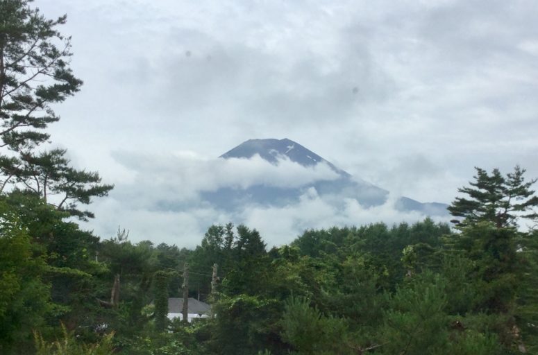
Tucked away in the heart of the Gruyère Regional Nature Park is an astonishing bouldering area called Tsavas. At almost 1’600m, these boulders lie just underneath the Vanil Noir mountain range in the Swiss Canton of Fribourg. You’ll have to go out of your way to get here though, with no public transport link, and your only option being a winding one lane road up the picturesque mountainside. Then, a further 45min hike up 400m will finally see you to the area. Your reward? A stunningly beautiful mountain valley, rolling green hills and some fantastic blocks just waiting to be climbed.
Tsavas is made up of a wide plane of grassy fields and rock rubble semi-circled by the flanks of the main mountain range. The boulders are easily accessible along small paths and scattered along a winding stream. The area is sun facing for most of the day, and in high summer the last rays of light will disappear at around 9p.m. making it an excellent afternoon spot from June to August. Just ensure you check the weather forecast in advance. There is little shelter from the rain. Plan for a 30min descent back down to the public parking space.
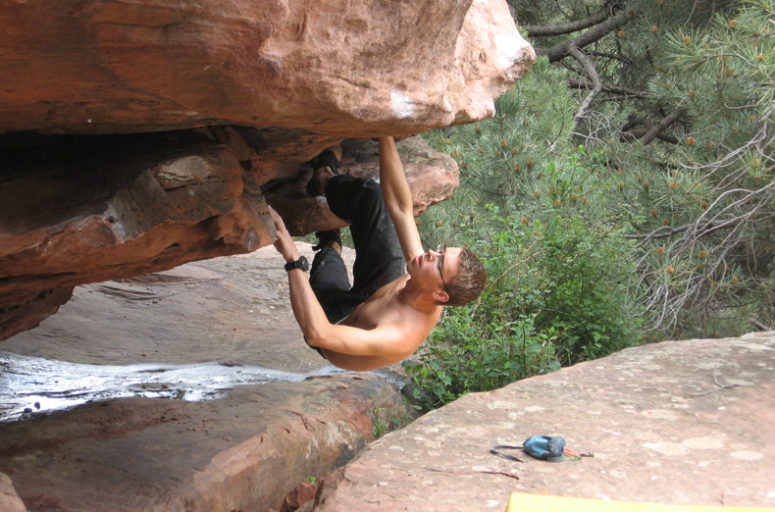
The boulders themselves come in all sorts of shapes and sizes, the granite ranging from small to huge “high-ball” blocks. The granite is sharp and compact, although take care in some areas as there can be brittle elements, with the rocks directly exposed to the elements all year round.
With four dedicated sectors, there is a wide spectrum of grades to be tackled, making this an ideal spot for all levels of climbing. However, due to this area being less frequented, many of the boulders can be dirty or covered in moss and shrubs, particularly at the lower end of the grading scale. Don’t let that stop you though as there are some fantastic lines to be found. A detailed guide for the area can be found in the app Bimano for a small price (see my article on the Bimano app here).
Landings are usually quite forgiving and relatively flat, but you may want to bring an extra crash mat or two as there are a few long traverses and some top outs which can be very high indeed. Also be aware that you will be sharing the valley with hundreds of grazing sheep and some blocks in particular will be covered in their poop… so tread carefully!
I can’t quite get over how beautiful this area is. Great boulders, clearly defined problems, sun all day round and the peace and quiet of the Swiss alms combine to make this a fantastic place to visit for an afternoon bouldering session or a whole day.
A word on approach:
The area lies just South of Gruyère town, and will take you through the village of Grandvillard. From there follow the small tarmacked road winding all the way up to the designated signed parking spot (about a 20 minute drive).
GPS coordinates for parking: 46°30’52.2″N 7°06’46.0″E
GPS coordinates for boulders: 46°30’50.5″N 7°07’11.1″E
From the parking you have two options:
Option 1: Walk back down the road a few metres until a dirt road turns off to the right. Follow this for 5 minutes until it takes a sharp left by the waterfall. Before the left turn, head into the grass on the right and continue until the foot of the grassy hill, you will then spot a small trampled path which snakes up the hillside next to the waterfall (you might not see it at first, but don’t worry it is there!). After 10 minutes it will dip into the forest and connect you to the main hiking path. Turn left at this point and continue up, crossing the waterfall bridge. As you start to reach the crest of the hill, keep right along the stream and you will see a small fence on your right which you can follow to the first sector “Warm Up”. (total hike is about 30 minutes).
Option 2: Continue on a few metres up the road from the parking until you hit the first farm on the right. Directly to your left is a small gate which you can enter. Follow the path a few metres to the next green gate and from there continue along the path until you hit Tsavas (see Option 1, about 40 minutes hiking time).
Highly recommend to download a GPS app on your phone, such as the excellent GPS Tracks. You will be able to see the hiking paths clearly on this and follow it all the way up to the bouldering area.